
Merganser Bay to Keith's Bay in West Bay of Lake Nipissing
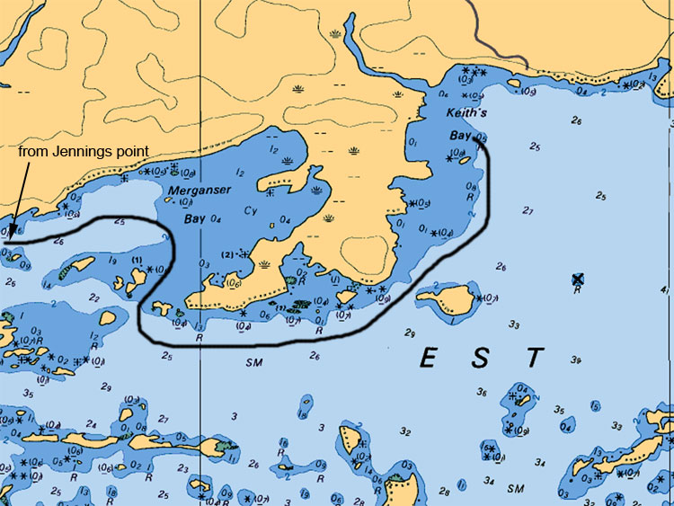
Further to the east as you leave Merganser Bay you will come up on a huge bay named Keith’s Bay. On a southwest wind this bay allows you to drift nearly a mile over various bottom configurations and species habitat. It is not uncommon on a single drift to catch a Walleye, a Northern Pike, a Bass and a few Jumbo Perches. The average depth of Keith’s Bay is anywhere from 6 to 8 feet with tons of cabbage weed patches throughout its entirety. The route to get there is somewhat tricky and must be taken very carefully. From Keith's Bay you are only a few miles away from the main Basin of Lake Nipissing.
Map Legend:
Depth are in meters (ex 6.4 or 8 or5.2, the larger number represents main value the second represents the decimal value)
Tan (gold or yellow) represents Land. Dark Blue shallow water 2 meters or less. Light Blue represents waters between 2 to 5 meters. White represents waters 5 meters or more in depth
Anywhere on the map you see (05) or (0) is a shallow area or rocky area
All stars or plus sign with 4 dots indicates submerges rocks
The R attributed with a depth value means rocks submerged at represented depth
Ideal Time of Year to Fish West Arm of Lake Nipissing
Walleye: From opening in mid May to Mid August
Northern Pike: From opening in mid May to closing mid October
Bass (largemouth and small mouth): From its opening 3rd Saturday in May to mid September
Musky: From its opening in mid June to end July and Mid September to end of October
Fishing Areas & Maps
Let's breakdown the West Bay into fishing areas, describe them and tell you where and how to fish these honey holes.