
Bear Bay to Umbrella Island's in West Bay of Lake Nipissing
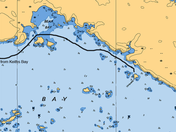
Umbrella Islands lie southeast of Bear Bay approximately 1 mile away. The 2 small islands in West Bay of Lake Nipissing received their name as the result of a tree shaped like an umbrella on the far most east island. This area is awesome for walleyes as you fish from all sides of the 2 islands. On the east side approximately 1,300 feet sits a large boulder home of a lot of Small Mouth Bass.
Map Legend:
Depth are in meters (ex 6.4 or 8 or5.2, the larger number represents main value the second represents the decimal value)
Tan (gold or yellow) represents Land. Dark Blue shallow water 2 meters or less. Light Blue represents waters between 2 to 5 meters. White represents waters 5 meters or more in depth
Anywhere on the map you see (05) or (0) is a shallow area or rocky area
All stars or plus sign with 4 dots indicates submerges rocks
The R attributed with a depth value means rocks submerged at represented depth
Ideal Time of Year to Fish West Arm of Lake Nipissing
Walleye: From opening in mid May to Mid August
Northern Pike: From opening in mid May to closing mid October
Bass (largemouth and small mouth): From its opening 3rd Saturday in May to mid September
Musky: From its opening in mid June to end July and Mid September to end of October
Fishing Areas & Maps
Let's breakdown the West Bay into fishing areas, describe them and tell you where and how to fish these honey holes.