
Daster's Narrow to Black Bay of West Arm on Lake Nipissing
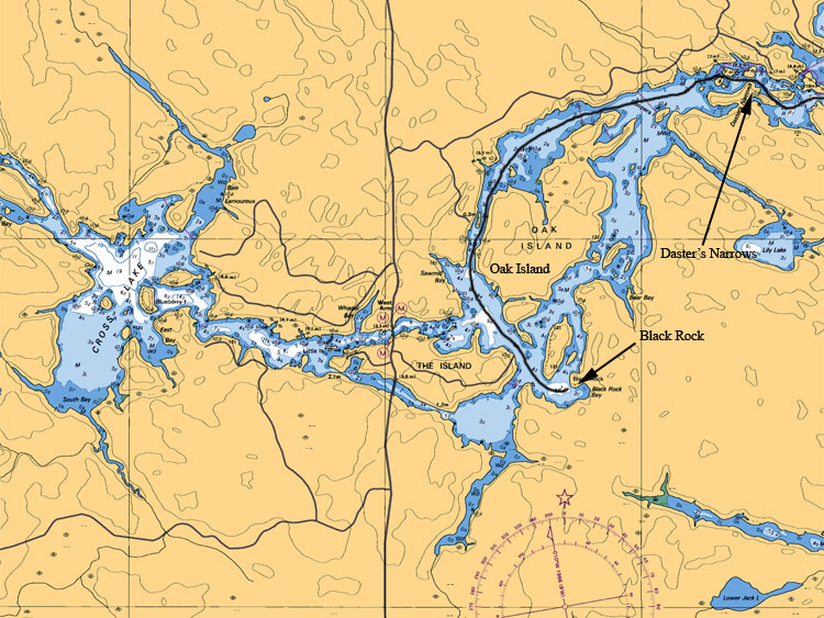
From Daster's Narrows which is 8 miles from Memquisit Lodge the area gets more populated and more boat traffic will be apparent as you navigate past oak island (10 miles from lodge) and to the junction where you can go to either west arm bridges (11 miles from lodge). Our journey ends at Black Bay (12 miles from lodge) where there is Black Rock a popular high cliff that people will jump off into the water.
Map Legend:
Depth are in meters (ex 6.4 or 8 or5.2, the larger number represents main value the second represents the decimal value)
Tan (gold or yellow) represents Land. Dark Blue shallow water 2 meters or less. Light Blue represents waters between 2 to 5 meters. White represents waters 5 meters or more in depth
Anywhere on the map you see (05) or (0) is a shallow area or rocky area.
All stars or plus sign with 4 dots indicates submerges rocks
The R attributed with a depth value means rocks submerged at represented depth
Ideal Time of Year to Fish West Arm of Lake Nipissing
Walleye: From opening in mid May to Mid August
Northern Pike: From opening in mid May to closing mid October
Bass (largemouth and small mouth): From its opening 3rd Saturday in May to mid September
Musky: From its opening in mid June to end July and Mid September to end of October
Fishing Areas & Maps
Let's breakdown the West Arm into fishing areas, describe them and tell you where and how to fish these honey holes.