
Memquisit to Mattawa Island's in West Bay of Lake Nipissing
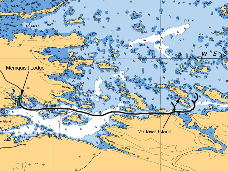
Mattawa Island is located approximately 5 miles east of Memquisit Lodge. The route to this island is well marked by green and red channel markers present over the entire south shore of West Bay of Lake Nipissing. Fish Mattawa Island all along its shore facing south. Pay special attention at the green channel marker since it is adjacent deeper waters. This area will be fruitful with walleyes and northern pike.
Map Legend:
Depth are in meters (ex 6.4 or 8 or5.2, the larger number represents main value the second represents the decimal value)
Tan (gold or yellow) represents Land. Dark Blue shallow water 2 meters or less. Light Blue represents waters between 2 to 5 meters. White represents waters 5 meters or more in depth
Anywhere on the map you see (05) or (0) is a shallow area or rocky area
All stars or plus sign with 4 dots indicates submerges rocks
The R attributed with a depth value means rocks submerged at represented depth
Ideal Time of Year to Fish West Arm of Lake Nipissing
Walleye: From opening in mid May to Mid August
Northern Pike: From opening in mid May to closing mid October
Bass (largemouth and small mouth): From its opening 4th Saturday of June to mid September
Musky: From its opening in mid June to end July and Mid September to end of October
Fishing Areas & Maps
Let's breakdown the West Bay into fishing areas, describe them and tell you where and how to fish these honey holes.